FAQs and Glossary
- Tidal flooding. This occurs during high spring tides and during storm events.
- Wave overtopping. There is a risk of waves crashing over the top of Weymouth’s seafront.
- Weymouth is also at risk of flooding from the River Wey when high river flows coincide with a high tide.
- Surface water flooding happens when heavy rainfall runs off the streets and floods areas throughout the town.
low, mean and high sea levels and every point in between, will be approximately 0.2m higher in 20 years, and approximately 1m higher in 100 years.
In twenty years time, a tide which has a 4% chance of occurring in any year now will have a 20% chance of occurring in any year.
In 100 years time, an extreme high tide that has a 0.5% chance of occurring in any year now, will be likely to occur every year
The northern part of the esplanade is at risk of coastal erosion, and possibly flooding from the sea before 2042. Therefore, we aim to improve the esplanade sea defence wall.
The inner harbour in Weymouth already experiences flooding during high spring tides due to asset failure. The walls in the harbour will likely require a combination of raising and replacement to reduce the risks of flooding in this area.

Why does Weymouth need a flood and coastal defence scheme?
Weymouth is susceptible to flooding and is impacted by coastal erosion. The issues of flood risk and loss of beach facing Weymouth will increase with sea level rise and more intense weather events; two key impacts from climate change.
Without investment in flood and erosion risk management, Weymouth faces increasing damages to property and infrastructure, which will impact our community.
What is coastal erosion?
Coastal erosion is a natural process where material (sediment, rocks and man-made features) is taken away from shorelines. This is not replaced by new material, resulting in the coastline being ‘eroded’. Waves, currents, tides, and wind can all contribute to coastal erosion.
For Weymouth, this could mean eroding the sand below the esplanade, causing the esplanade to collapse and retreat. Or it could affect the harbour walls, causing them to collapse which will impact land near the walls, as the roads and carpark may become unusable.
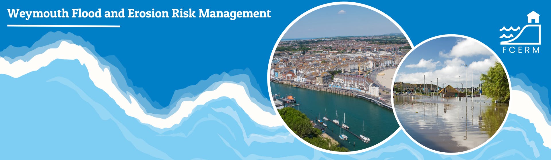
What are the different types of flood risks in Weymouth?
Weymouth experiences four different sources of flood risk:
What are the impacts of climate change on flood risk in Weymouth?
Climate change is causing an increase in flood risk due to sea level rise and storms which happen more often and are more severe.
If we don’t act, this means we are likely to see more flooding affecting Weymouth into the future.
The predictions for future climate change and its effects are based on the Met Office’s UK Climate Projections 18. They are representative of a high greenhouse gas emissions scenario in the future. This is known as RCP8.5 and represents a future with a potential temperature rise of 4 degrees Celsius, compared to the pre-industrial period (1850-1900).
At Weymouth:
By 2120, it’s predicted that the extreme tidal sea level in Weymouth will be around 1.3m higher than today.
With flooding being more severe, and more areas being flooded, it is predicted that more commercial and residential properties in Weymouth will be at risk.
What are the different types of coastal erosion?
Coastal erosion is caused by tides, currents, wave action and coastal flooding which wear down or carry material, such as rocks, soils or sands along the coast. This can result in movement of material over time and changes to the shoreline position.
Hard, rocky shorelines erode relatively slowly, as waves continually strike the cliff face and cause the material to crack and splinter. Loose fragments of rock and other beach materials are moved around by ongoing wave forces. This causes further erosion of the cliff.
Sand dunes and beaches can rapidly erode following high tide events which coincide with stormy seas and strong waves. The energy from breaking waves causes sand on the beach to move, and it is transported offshore as the water recedes. In future, predicted increases in storm frequency and intensity will cause increased coastal erosion.
Sea level rise can cause an increase in coastal erosion. Hard structures, such as seawalls, aim to keep the shoreline in the same position. However, as water levels increase, erosion also increases where the manmade defence meets the natural beach level, resulting in a loss of beach area.
What are the main aims of the proposed scheme?
The scheme has several aims and objectives. It aims to enhance the resilience of people, property, and infrastructure in Weymouth to flood and coastal change over the next 20 years and inform policy and plans for future years. In doing so, the scheme will provide a platform for future regeneration and growth of the town centre, Weymouth Harbour and the Esplanade that connects to local plans and strategies.
Where appropriate the scheme will prioritise sections of harbour walls that are currently lower in height, close to end of design life, or sections identified along the esplanade which are at highest risk of erosion.
The scheme aims to provide safe, resilient, and inclusive infrastructure and spaces for all users around Weymouth Harbour and the Esplanade by working with others, where practicable, to enhance and protect the quality of the natural and historic environment in the town.
What areas are affected by the scheme?
This scheme will focus on two key areas in Weymouth:
We will also consider ways to manage surface water flooding, which may include an area beyond the two areas mentioned above.
What sort of changes to the esplanade and harbour are you proposing?
In 2021, Dorset Council produced an initial business case known as a Strategic Outline Case (SOC) to secure funding for the more detailed Outline Business Case (OBC). This was approved by the Environment Agency.
The SOC recommended that the changes made to Weymouth’s esplanade and harbour occur in phases. It was proposed that Phase 1 of the work is to replace harbour walls which are in a poor condition and raise the level of the walls to increase the standard of flood protection to predicted 2042 levels. Phase 1 also proposes improvements to the Esplanade flood wall.
Future phases of work (to address continued sea level rise after 2042) may involve further raising of harbour and esplanade walls or the inclusion of a tidal barrier. A tidal barrier is a moveable gate that will likely be located near the harbour entrance and have the ability to be closed during extreme high tides to prevent high sea levels entering the town via the harbour. These future phased changes may take place over the next 100 years, which allows for future decision-making to be made using the best available information and knowledge.
What options are being considered to address flooding from the river Wey?
Phase one does not currently intend to address flooding from the River Wey as there is lower risk to properties from the river. However, we are looking at future flood risk from the river in more detail. If the updated assessment of flooding from the River Wey changes our current understanding, then the business case may consider options for mitigation in addition to the harbour and esplanade proposed works.
What options are being considered to address surface water flooding?
The first phase of our work focuses on understanding the severity of surface water flooding. When we have a better understanding, we will work with our partners to explore options to better manage surface water flooding. Any new defences will have to adequately manage the surface water risk so that flood risk to property is not shown to be increased.
How long will it take to complete scheme?
The Outline Business Case (OBC) is expected to finish in Summer 2026. If funding is secured from the government and other organisations, we plan to progress to detailed design and obtaining the appropriate environmental and planning permissions. Options identified as part of this scheme are unlikely to commence with construction before 2028. You may see some works to the harbour walls earlier than this date, but these are part of a separate project to strengthen the walls. We will be working with those projects to make flood risk improvements at the same time where this can bring efficiency savings and minimise disruption.
What has been done in the past to protect Weymouth from flooding?
The existing coastal flood defences in Weymouth Harbour are of different ages and conditions. During 2001 to 2002, the Environment Agency raised walls in one part the harbour to 2.3mAOD as part of a flood protection scheme.
Dorset Council undertakes periodic beach reprofiling and recycling (where lost sand and sediment is replaced) along the beach from the Pleasure Pier to the Greenhill Rock Groyne. This works to protect Weymouth from coastal flooding and prevent undermining of the existing seawall erosion. Improvements have also been made to the harbour walls in Weymouth more recently, though these were typically carried out to extend the lifespan of those walls and enable an operational harbour for all users.
How is the scheme being funded and how much will it cost?
We are at very early stages of understanding the problem and identifying potential solutions. As such we cannot estimate construction costs as we have not confirmed what the most appropriate solutions may be. The costs of the project will be estimated as part of the Outline Business Case currently being developed (due Summer 2026).
How does the scheme fit with Weymouth Town Council’s Neighbourhood Plan?
We are engaging with Weymouth Town Council to identify opportunities to align outcomes between the two initiatives. This is part of our strategic approach to delivering the Outline Business Case. We will also align the outcomes of the scheme to Dorset Council’s Local Plan where appropriate.
How does the scheme impact the town and surrounding areas?
If the Outline Business Case (OBC) is successful and the scheme fully funded, then the town, community and surrounding areas will benefit from enhanced flood resilience. The areas currently at risk of flooding will flood less frequently than they would without improvements. This should also provide environmental and regenerative benefits to the area.
How can I share my views about the proposals?
We are asking the local community what they think about coastal erosion, flood risk and resilience in Weymouth. To share your views please follow the link to complete a short survey: www.dorsetcoasthaveyoursay.co.uk/embeds/projects/19152/survey-tools/22315
How can I stay informed about the project? / How do I find out more information about the project?
To find out more information about the project and have your say in our consultations please visit the engagement platform for this project: www.dorsetcoasthaveyoursay.co.uk/weymouth-flood-defence-project
To stay up to date with the latest developments and receive ongoing updates please subscribe to DCF’s e-newsletter: www.dorsetcoast.com/get-involved/membership/
How will my home or business be impacted by the scheme?
At the OBC stage there will be minimum impact, other than from minor works associated with surveys that may be required. If the OBC is successful and the project progress to detailed design and construction, then you are likely to benefit from enhanced flood resilience. Properties that may be affected by construction will be contacted at the appropriate time, when the impacts of construction are better understood.
Will I be consulted before any physical works take place?
There will be further engagement with the community affected by the proposals as the project progresses.
Is my property at risk of flooding?
We recommend you visit the Environment Agency web pages to help you answer this question.
Who is carrying out the works / Who is responsible for the scheme?
Dorset Council is the lead organisation promoting and funding this Outline Business Case.