West Dorset Walkers Welcome
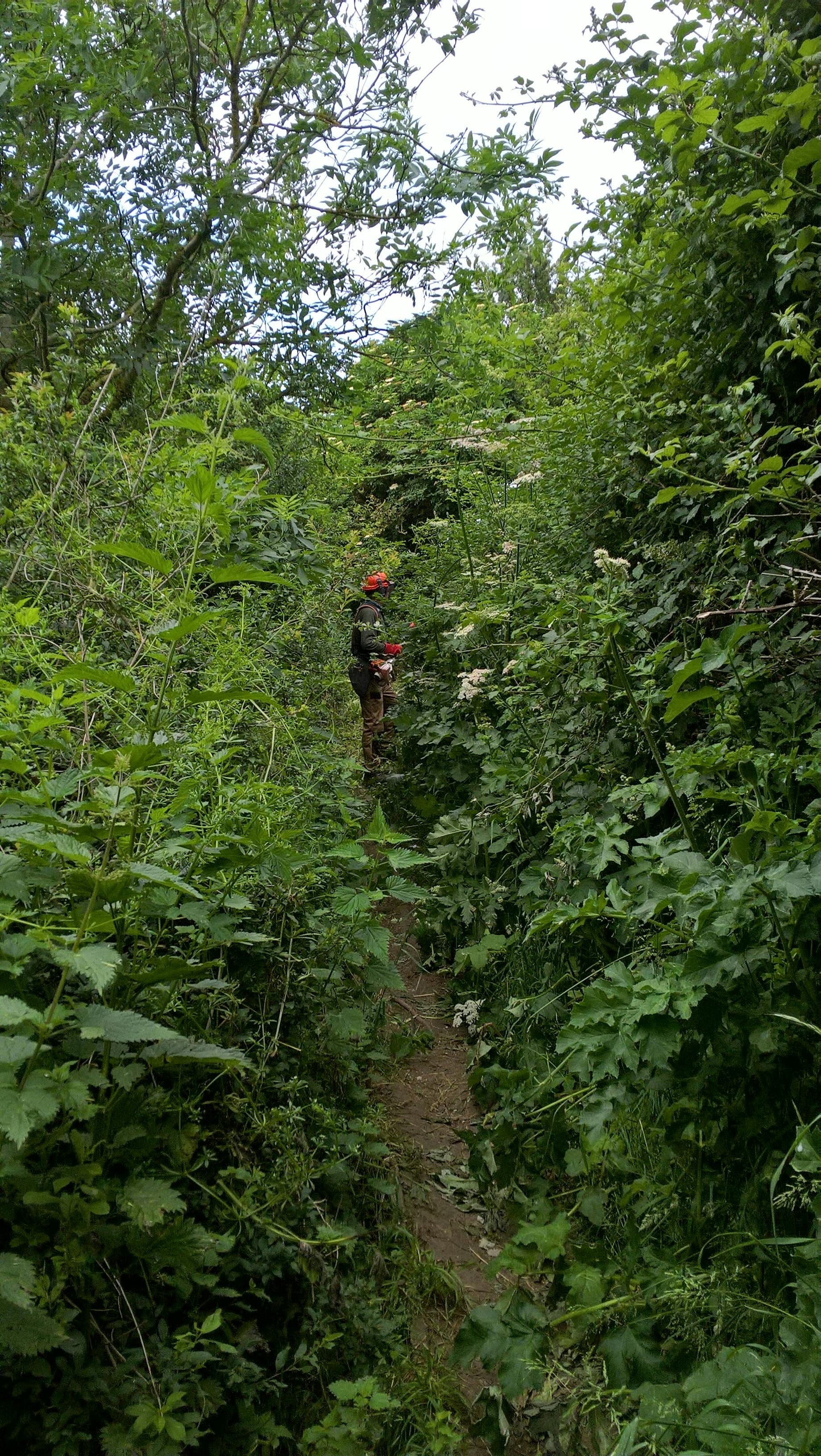
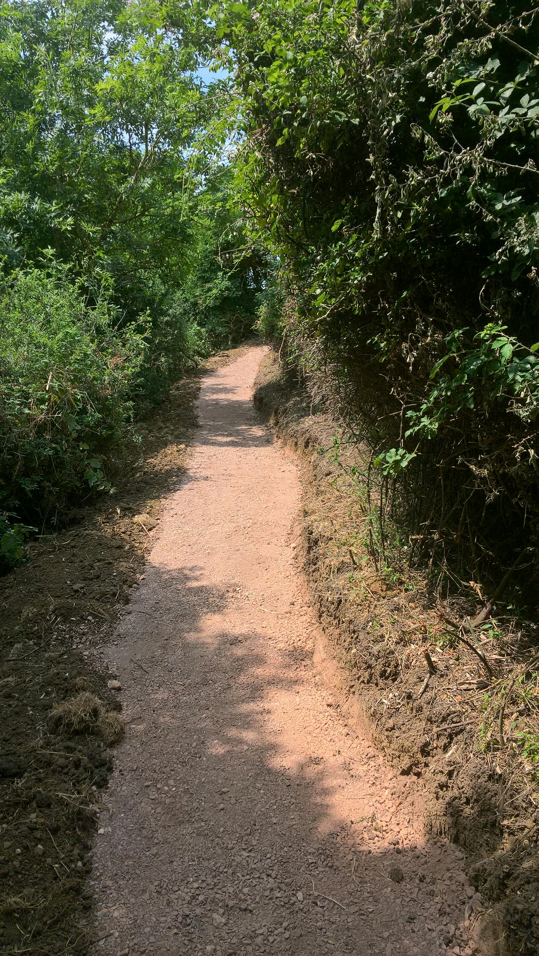
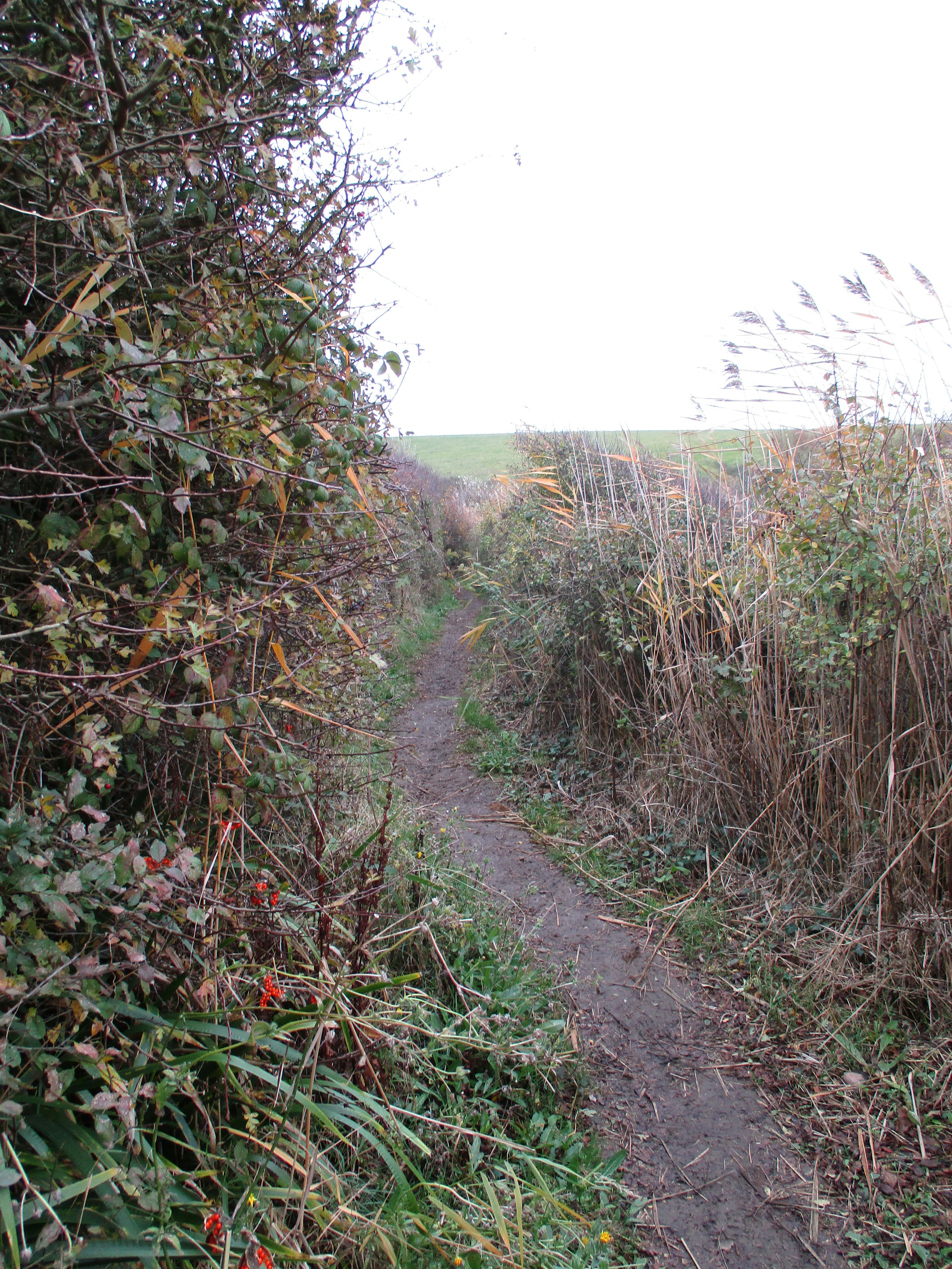
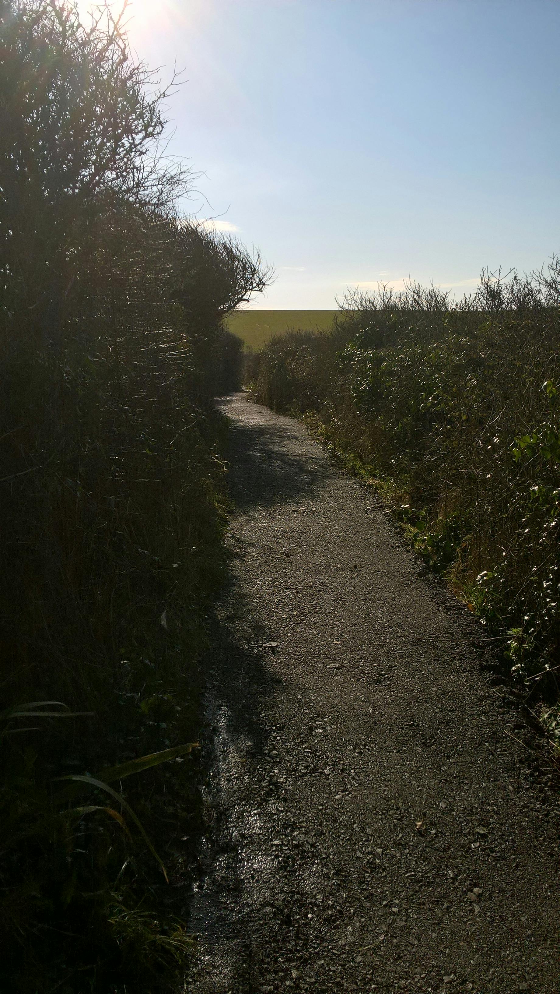
The Dorset Coast path is enjoyed by local people and visitors as a key way to experience and enjoy the stunning coastal landscape, sea views and numerous coastal communities through which it passes. The underlying geology and hydrology of the coastline result in a stunning topography which is subject to dynamic and sometimes rapid change, resulting in some difficult locations to navigate for the everyday walker. Many of these locations are found close to parish communities where the coast path is most popular. This project seeks to improve those locations.
West Dorset Walkers Welcome project is a two-phase, West Dorset Coast Path improvements and the artistic parish boundaries marker project.
West Dorset Coast Path improvements
Physical path improvement works at 12 locations along the Dorset Coast Path were carried out in 2019. Path works improved and facilitated year-round access for local people and visitors, for walkers to safely use and enjoy the path whilst also linking into local paths networks/parishes and parish attractions along the coast path.
Parish Boundary Markers
Parish boundaries markers provide welcome entry and exit points along the coast path highlighting for the traveller passage through coastal communities.
Local artists were commissioned in 2019 for the first stage and in 2021 for the second stage to develop contemporary parish boundary artwork pieces to reveal to the walker where and when they pass from one parish to another when walking along the West Dorset Coast path. These pieces are collaboration projects between the artist, landowners and craftspeople to produce artwork pieces that represents the heritage of that particular parish boundary using a range of materials such as, stone, wood, metal. This project has produced 16 unique, beautiful parish boundary markers demonstrating high quality expertise in both arts and crafts.
Click on map below to zoom in an view boundary marker locations.

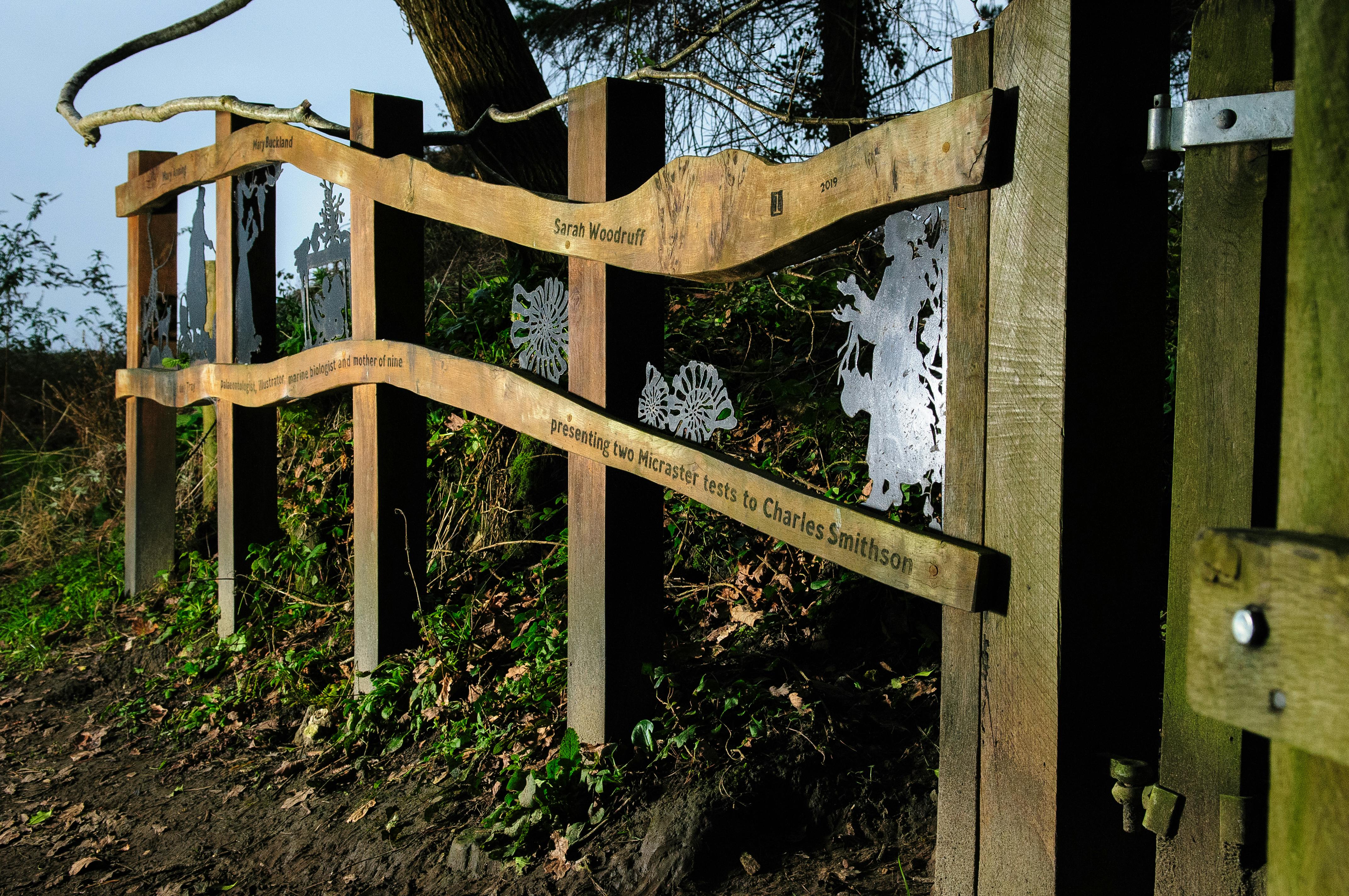
1. Devon into Dorset boundary at Ware: To celebrate the iconic 19thC women of Lyme Regis pivotal in Lyme Regis reputation as the cradle of modern palaeontology – Mary Anning, Mary Buckland, & Sarah Woodruff. Artists Alex Brooks and Emma Molony. Grid Reference SY 3312 9170.
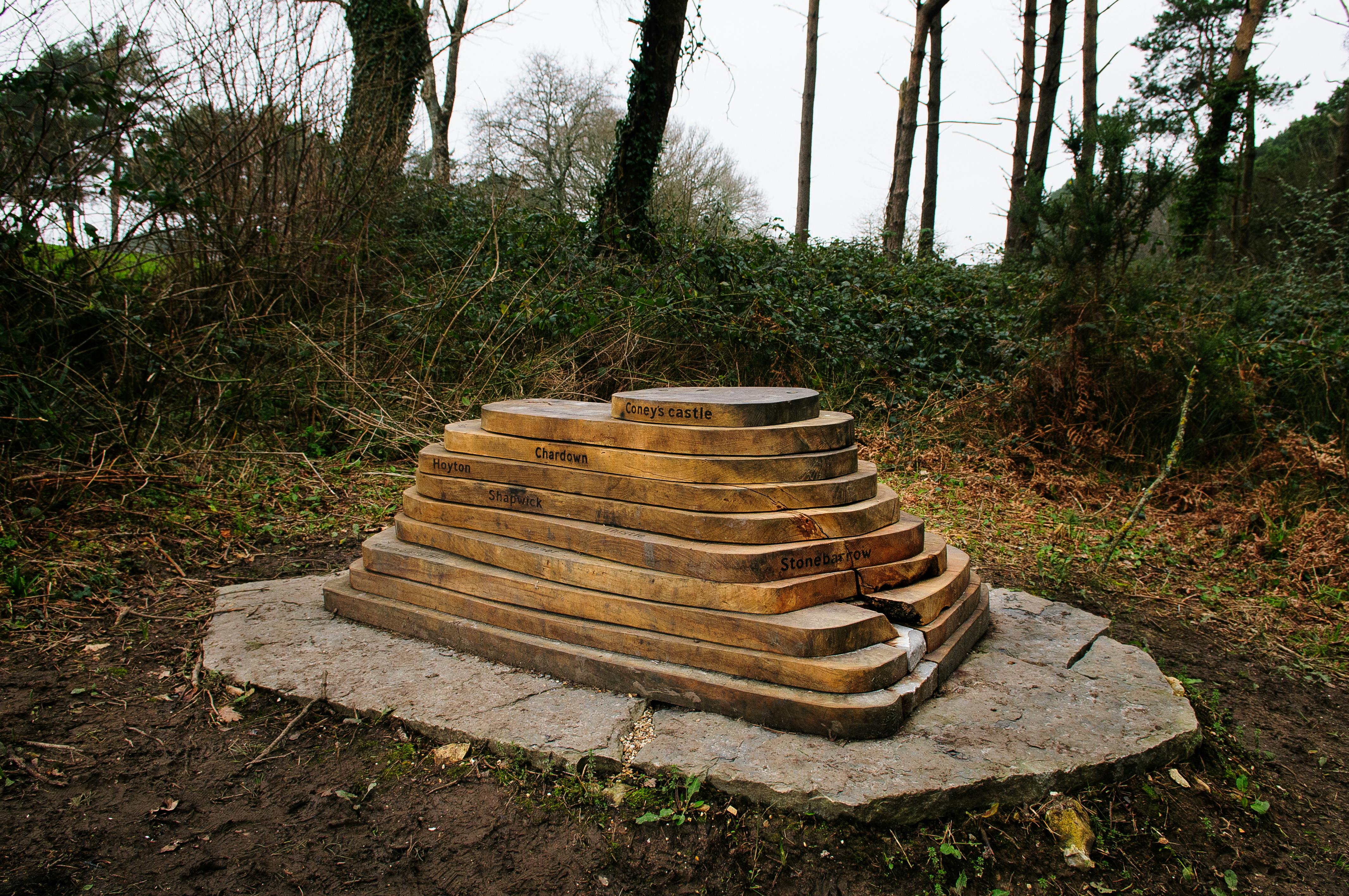
2. Lyme Regis to Wootton Fitzpaine boundary: Highlighting the beautiful undulating local landscape with its distinctive hilltops providing birds eye viewpoints, for example, Lamberts Castle, Colney Castle, Stonebarrow, and Trinity, Thistle and Timber Hills. Arts, craftsmen and brothers Alex & Ed Brooks. Grid Reference SY 35048 93 808.
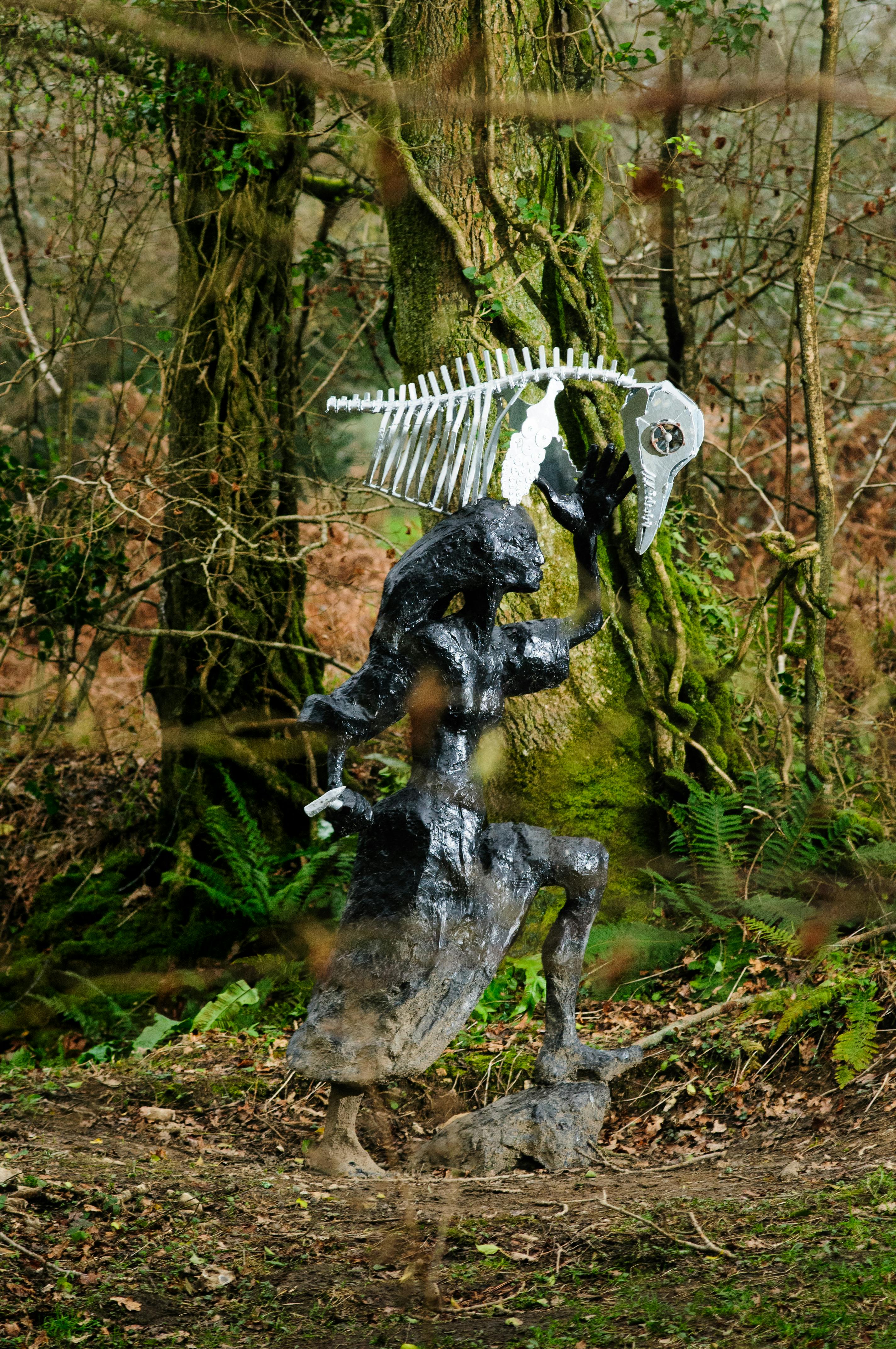
3. Wootton Fitzpaine to Charmouth boundary: Remembering Mary Anning and her work searching for fossils in the Charmouth mudstone cliffs and discovering the first correctly identified ichthyosaur. Artist Greta Berlin. Grid Reference SY 35048 93 808.
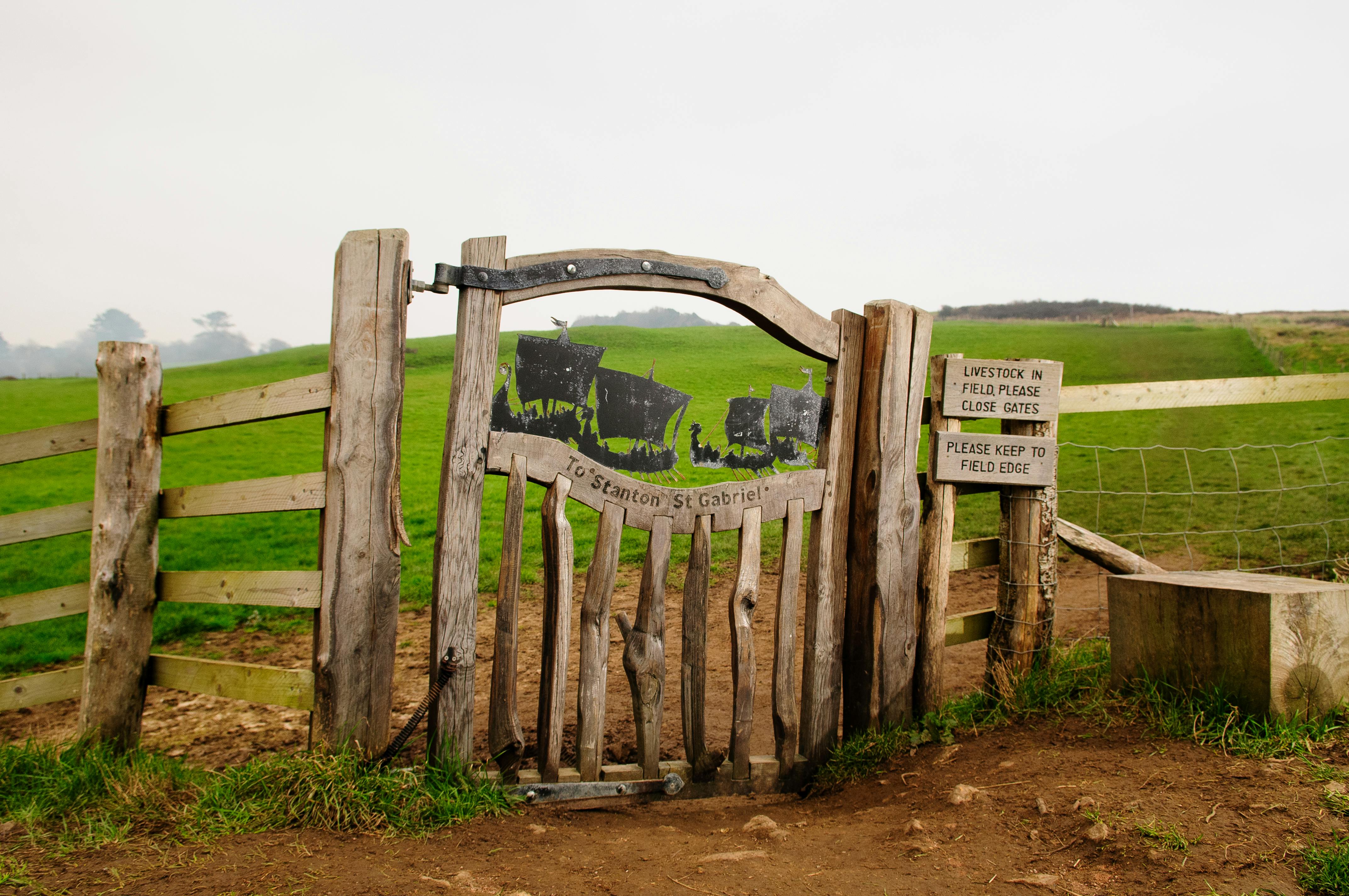
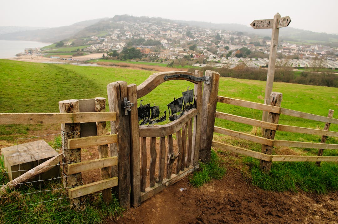
4. Charmouth to Stanton St Gabriel boundary: To commemorate the alleged 836 Danish Viking landings on Charmouth beach. As you approach the gate the Viking landskip warships align with the sea horizon to take you back in time and witness the Viking fleet advancing towards the shore. Artists Alex Brooks, Emma Molony, Simon Connett Blacksmith & Tara Hansford. Grid Reference SY 3698 9307.
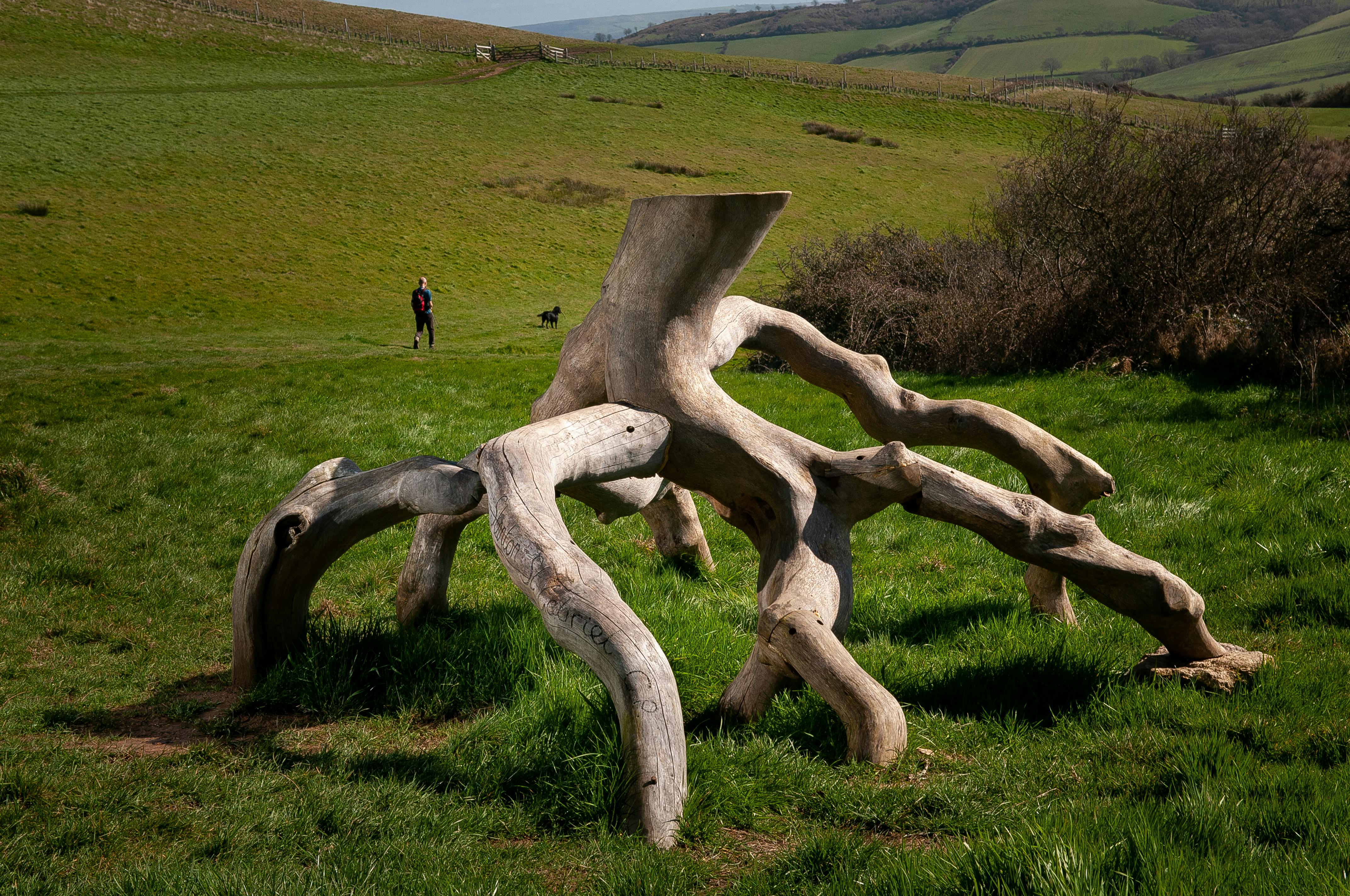
5. Stanton St Gabriel to Chideock boundary: Enhances the links between the two parish communities providing a seat sculpted from local fallen trees echoing the weathered trees and hedgerows in this location. Inviting local people and coast path walkers to stop, sit and contemplate and connect with their surroundings. Artist Isla Chaney. Grid Reference SY 4104 9215.
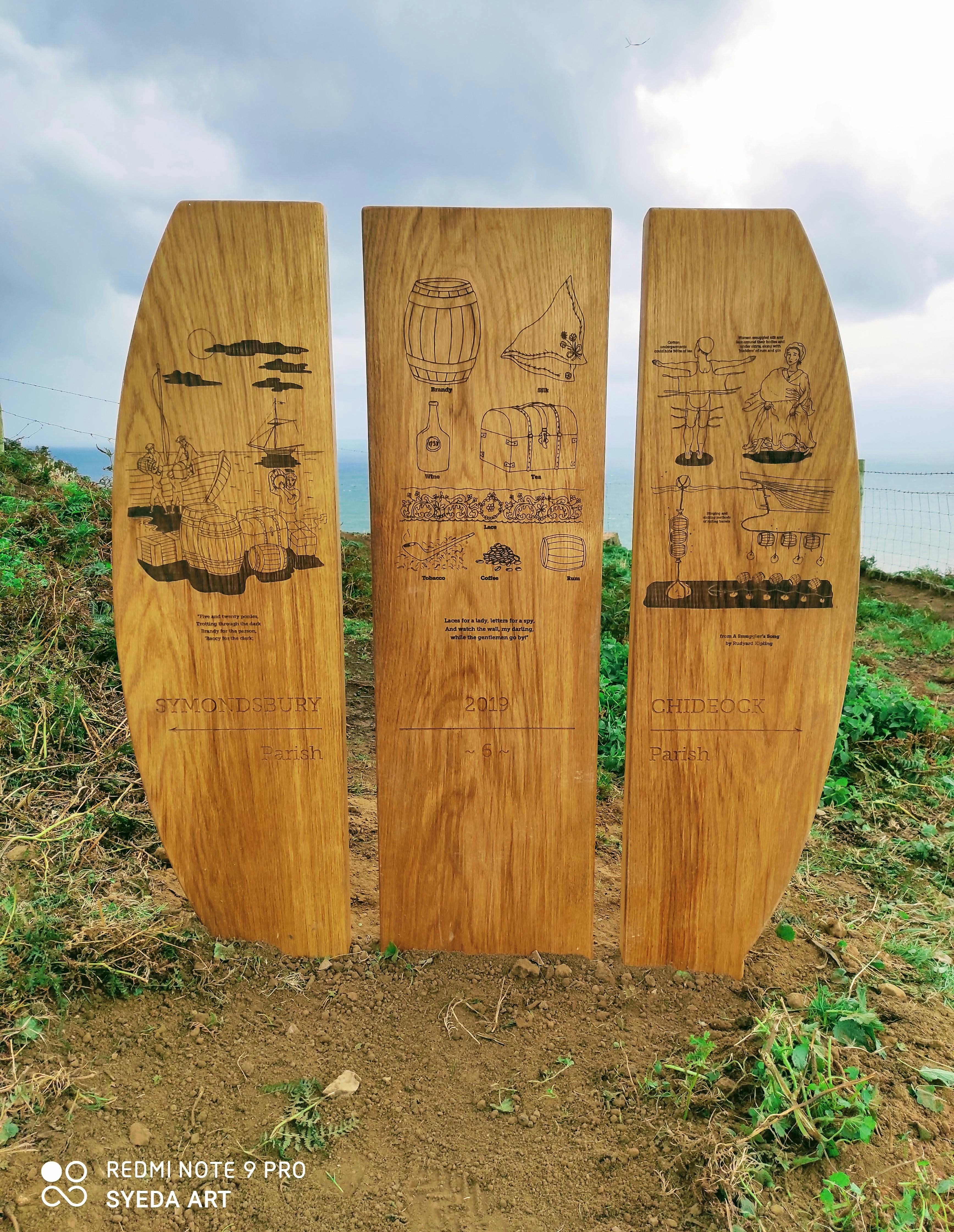
6. Chideock to Symondsbury boundary: From the distance the walker can see the form suggesting the shape of a barrel which when reached invites the walker to stop and consider the coasts rich smuggling history. Artist Delphine Jones. Grid Reference SY 4348 9146.
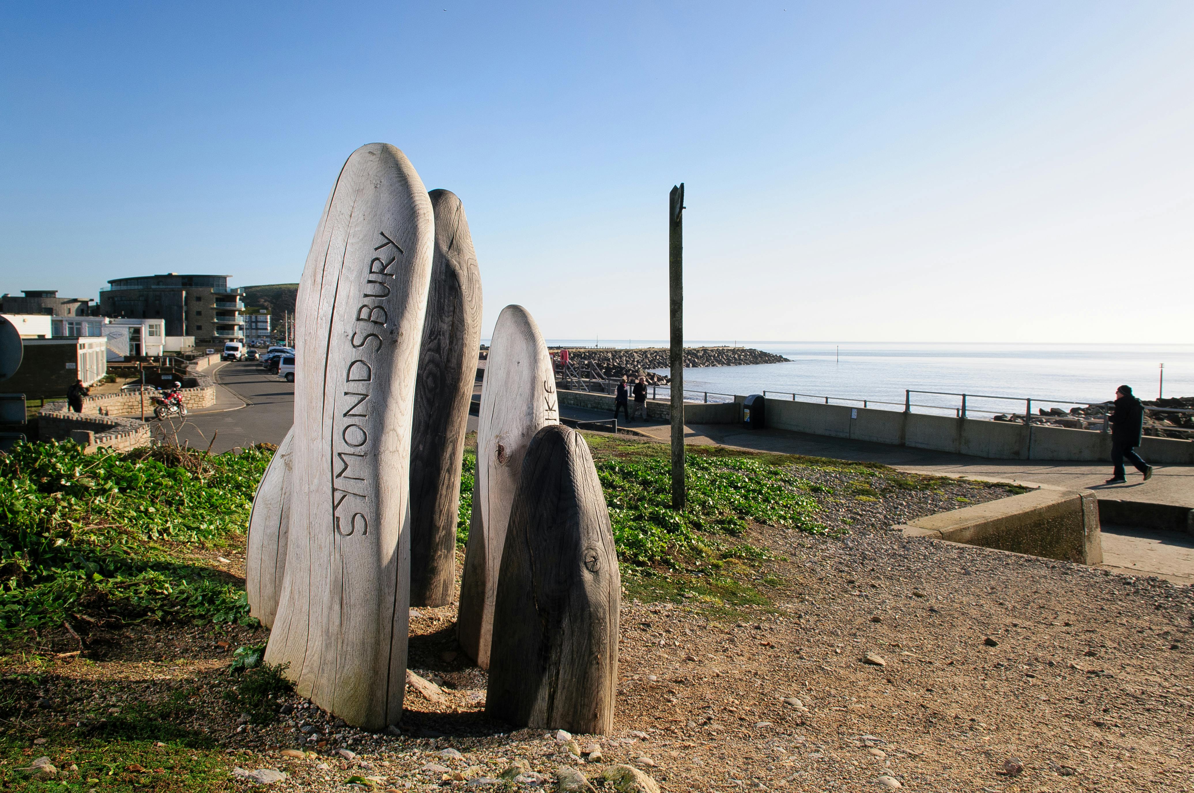
7. Symondsbury to Bridport boundary: Remembering the “Wildcats of Bridport” a group of women netmakers who downed tools, went on strike and marched in protest of a pay cut and secured the support of Bridport. Artist Alice Blogg. Grid Reference SY 4591 9048.
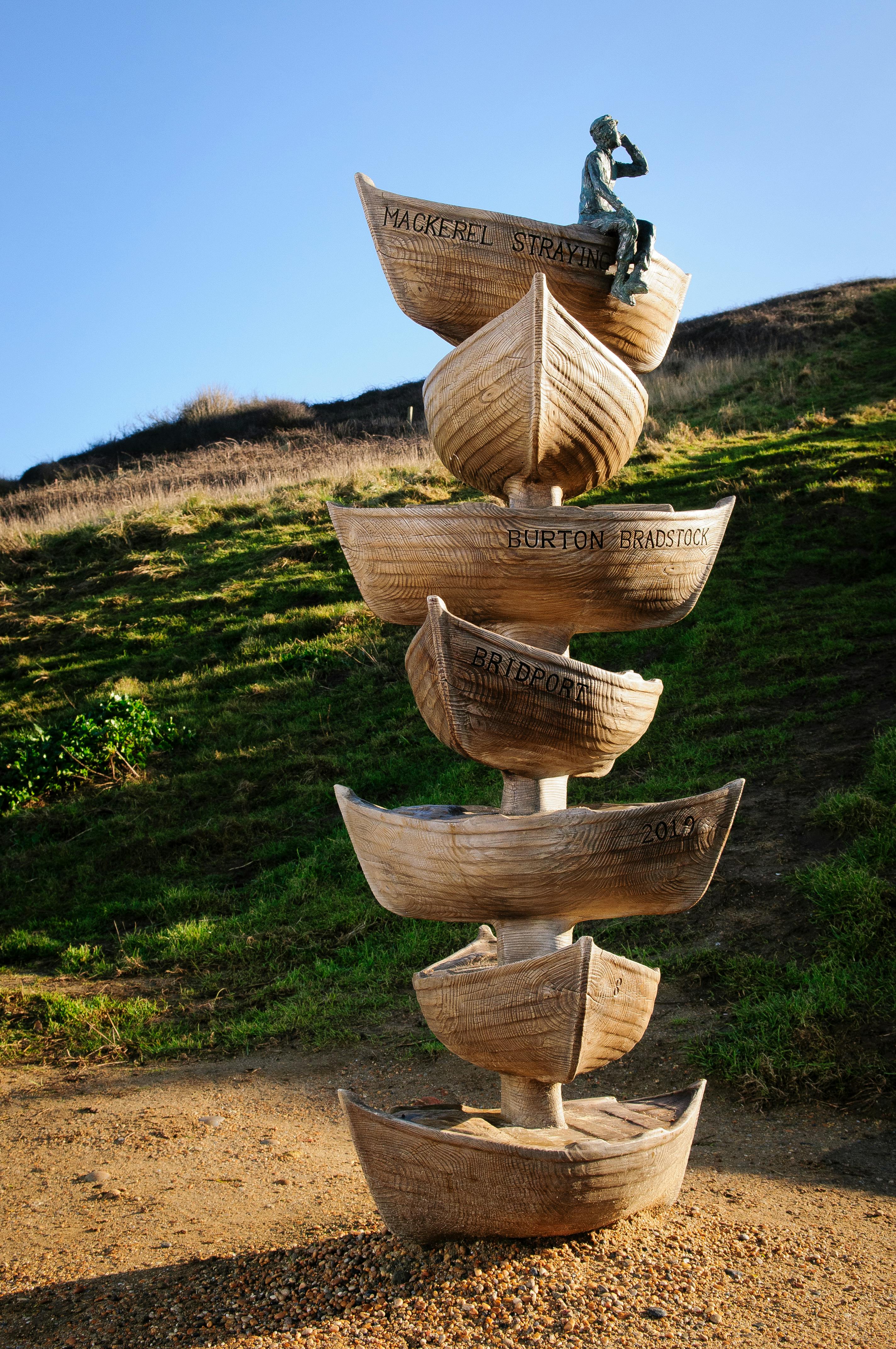
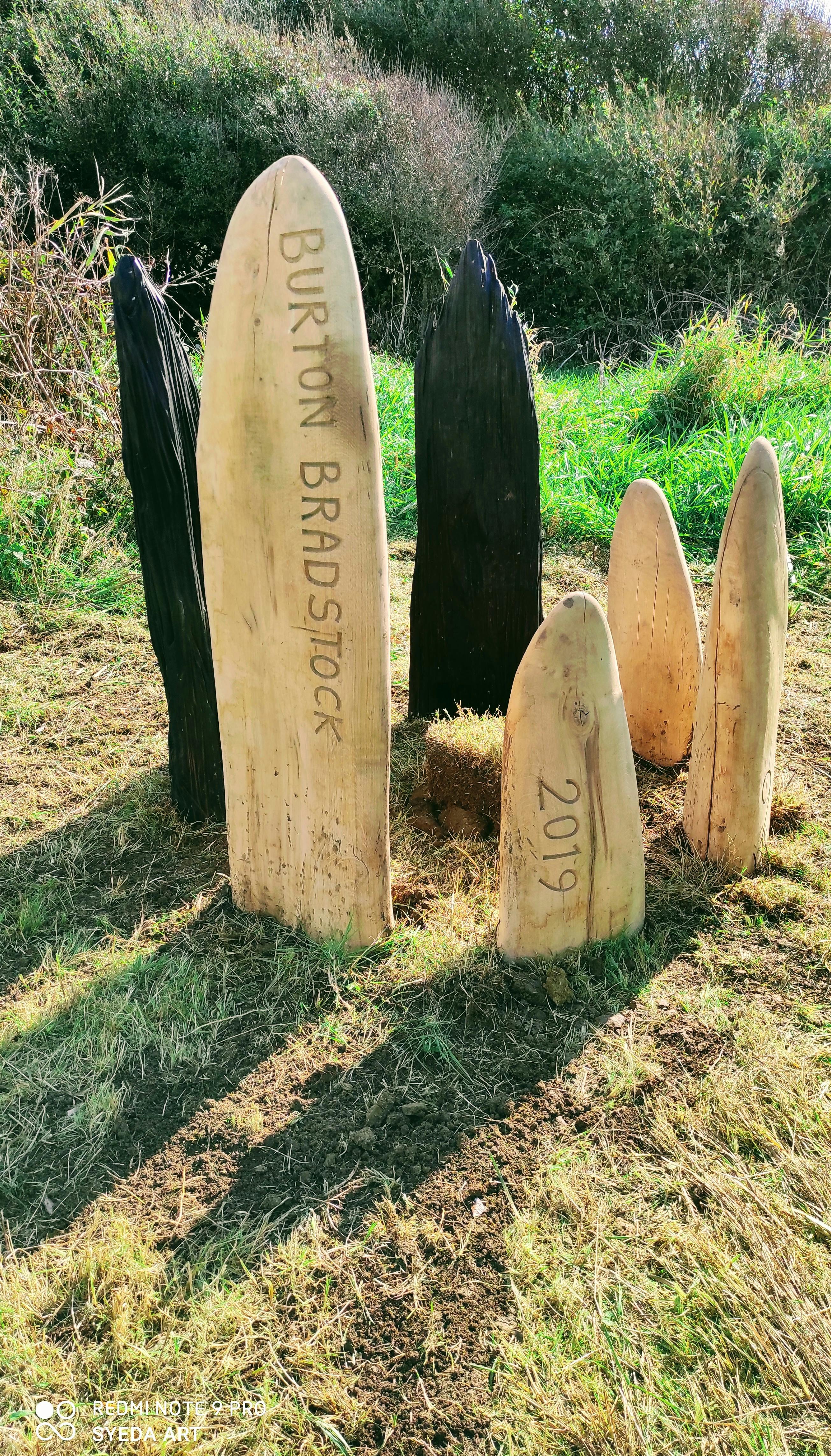
8. Bridport to Burton Bradstock boundary: Recollecting the “spotters” who stood up along the iconic west bay cliff top and when they saw a shoal of fish would shout out to the fishermen below “Mackerel Straying” This prompted the fishermen to launch their boats and fish! Artist Brendon Murless. Grid Reference SY 4644 9022.
9. Burton Bradstock to Swyre boundary: Echoing how this landscape changes from winter into summer with smooth, bleached to dark jagged elements. An Oak tree protected by them will grow and distort because of this exposed landscape but provide a permanent boundary marker for future generations. Artist Alice Blogg. Grid Reference SY 5106 8786.
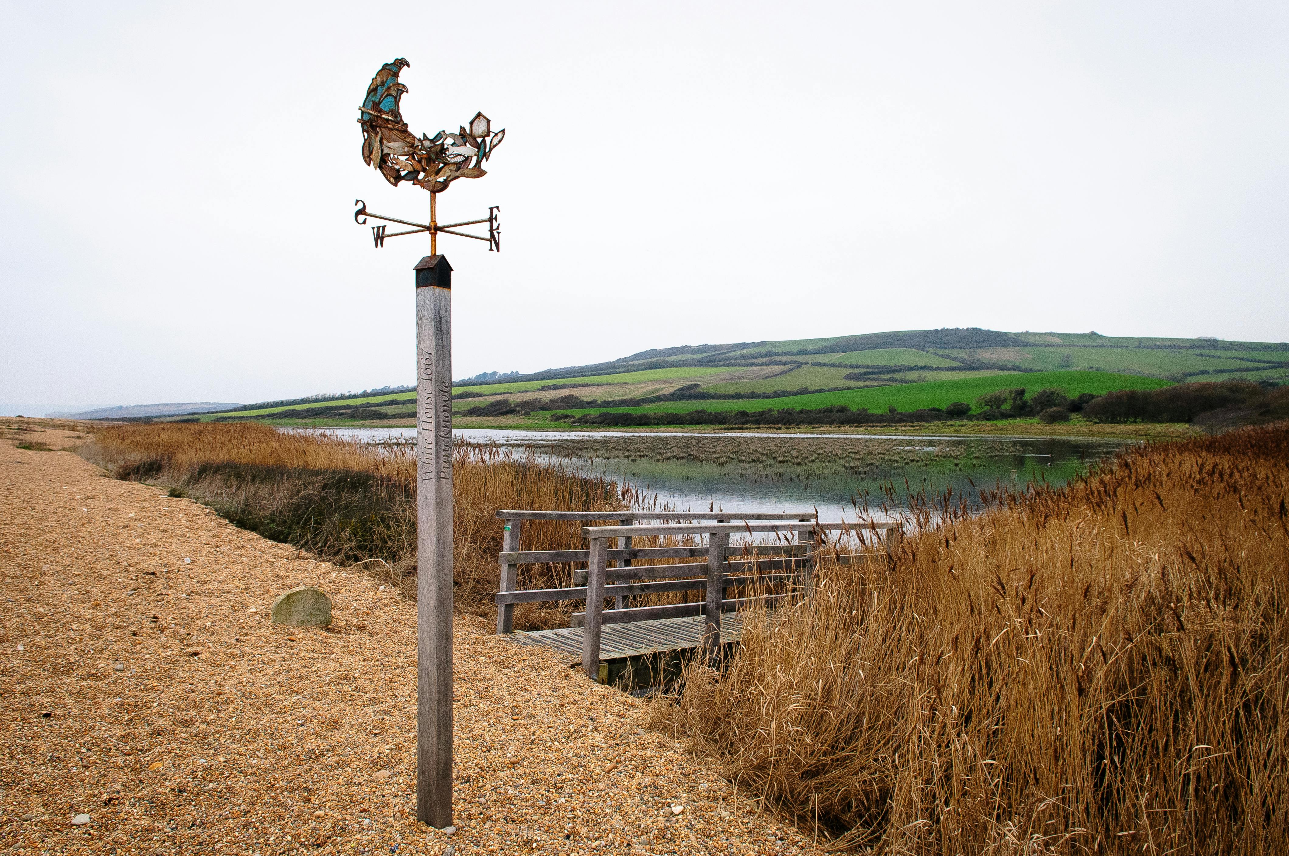
10. Swyre to Puncknowle boundary: In 1667 a white house stood on Chesil beach providing refuge for shipwrecked sailors washed up along the beach. Long since lost but remembered by a boundary marker that will help walkers brace themselves in windy weather! Artists Sarah Hough, Will Pinder Metal worker/forger & Jake Reilly Carpenter. Grid Reference SY 5401 8586.
11. Pucknowle to Abbotsbury boundary: Spiral tassleweed, common mouse ear, toothed medick …. this boundary marker celebrates the fascinating names of the remarkable plants supported by The Fleet and Chesil Beach. Artist Andrew Whittle. Grid Reference SY 5245 8689.
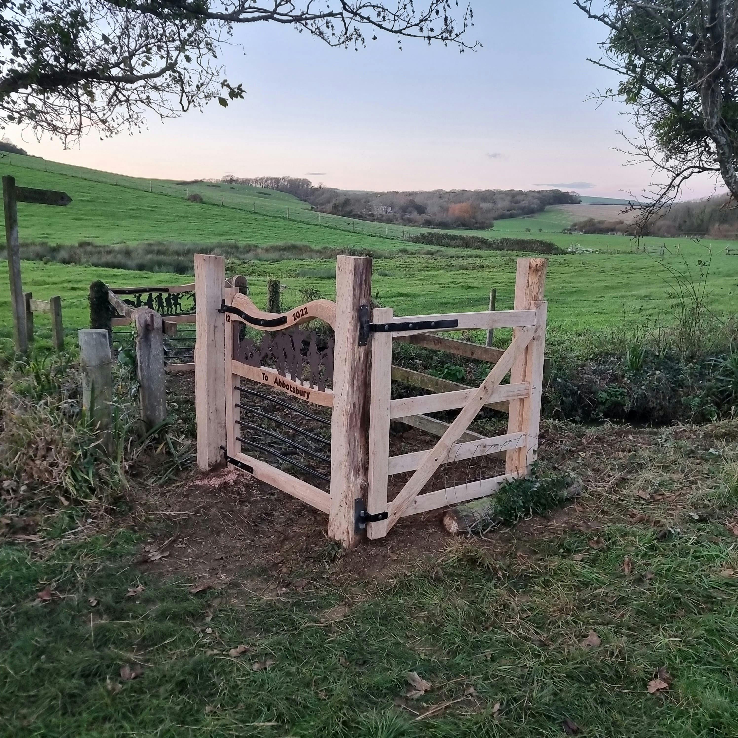
12. Abbotsbury to Langton Herring: Three hand-made gates, kissing fence and fencing over bridge. Incorporating artistic metalwork depicting historic imagery relating to the parishes. Artists Alex Brooks, Emma Molony, Simon Connett Blacksmith & Arc & Anvil Fabrication. Grid Reference SY 60597 82583.
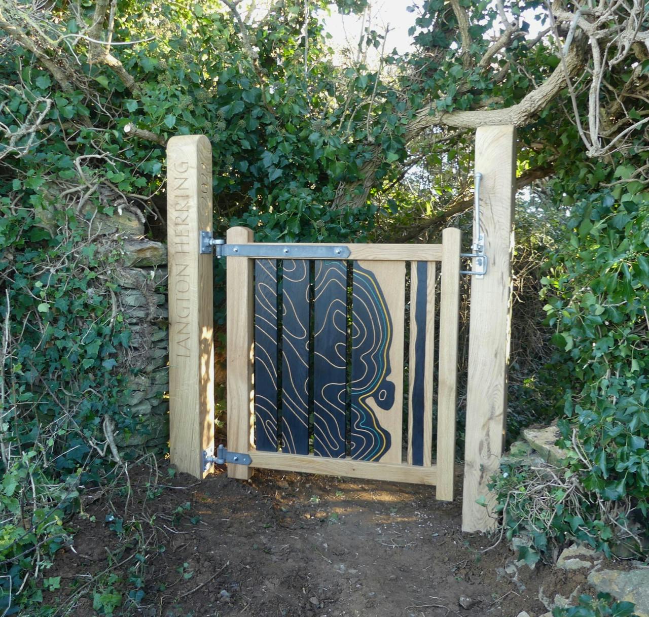
13. Langton Herring to Fleet: Hand-made gate depicting a map of the area showing the contour lines, the coast path ( yellow line) and the predicted sea level rise (blue line). Designed by artist Amanda Wallwork and made by sculptor Kit Benwell. Grid Reference SY 61596 80739.
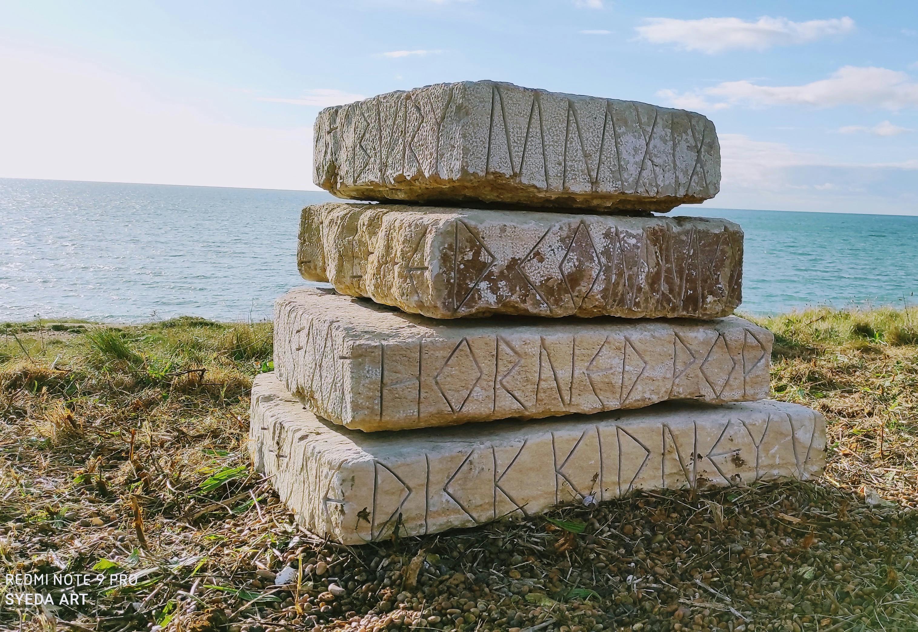
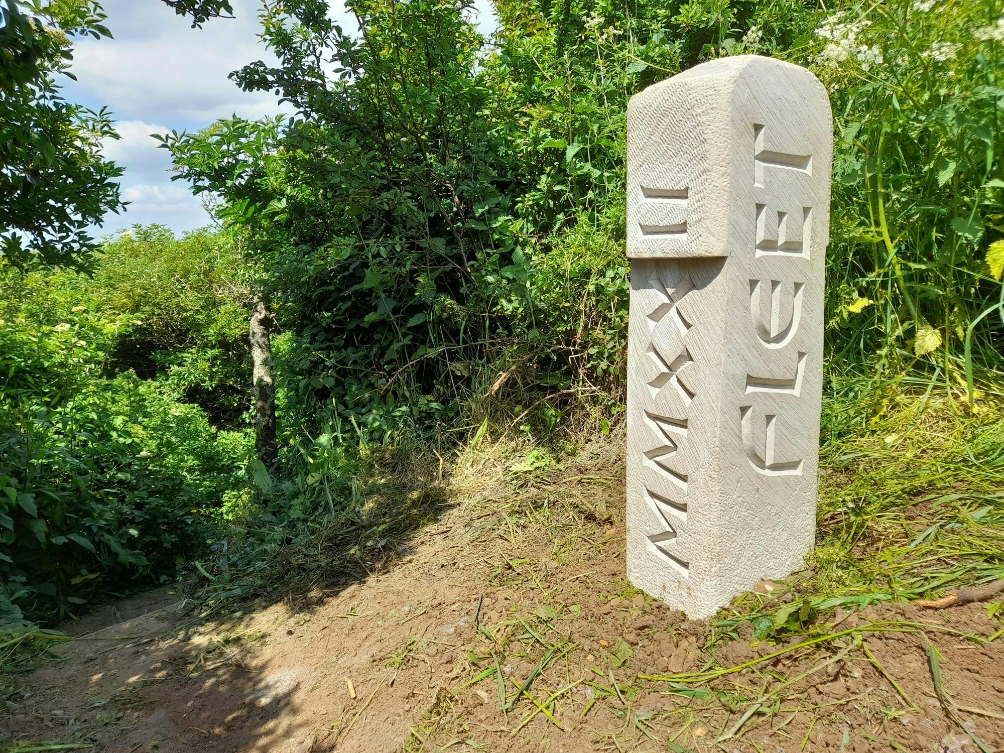
14. Fleet to Langton Herring. Stone boundary marker with letter carvings - to be installed when dry weather allows (updated March 23). Artist Andrew Whittle. Grid Reference SY 61596 80739.
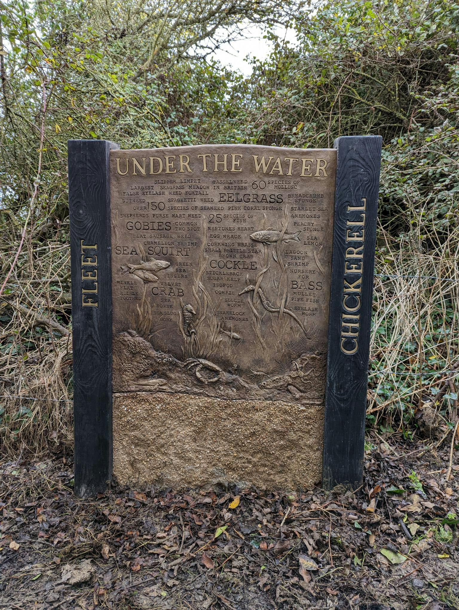
15. Fleet to Chickerell: 'Under the water' sculptured marine life information marker. Artist Brendon Murless. Grid Reference SY 64137 79220.
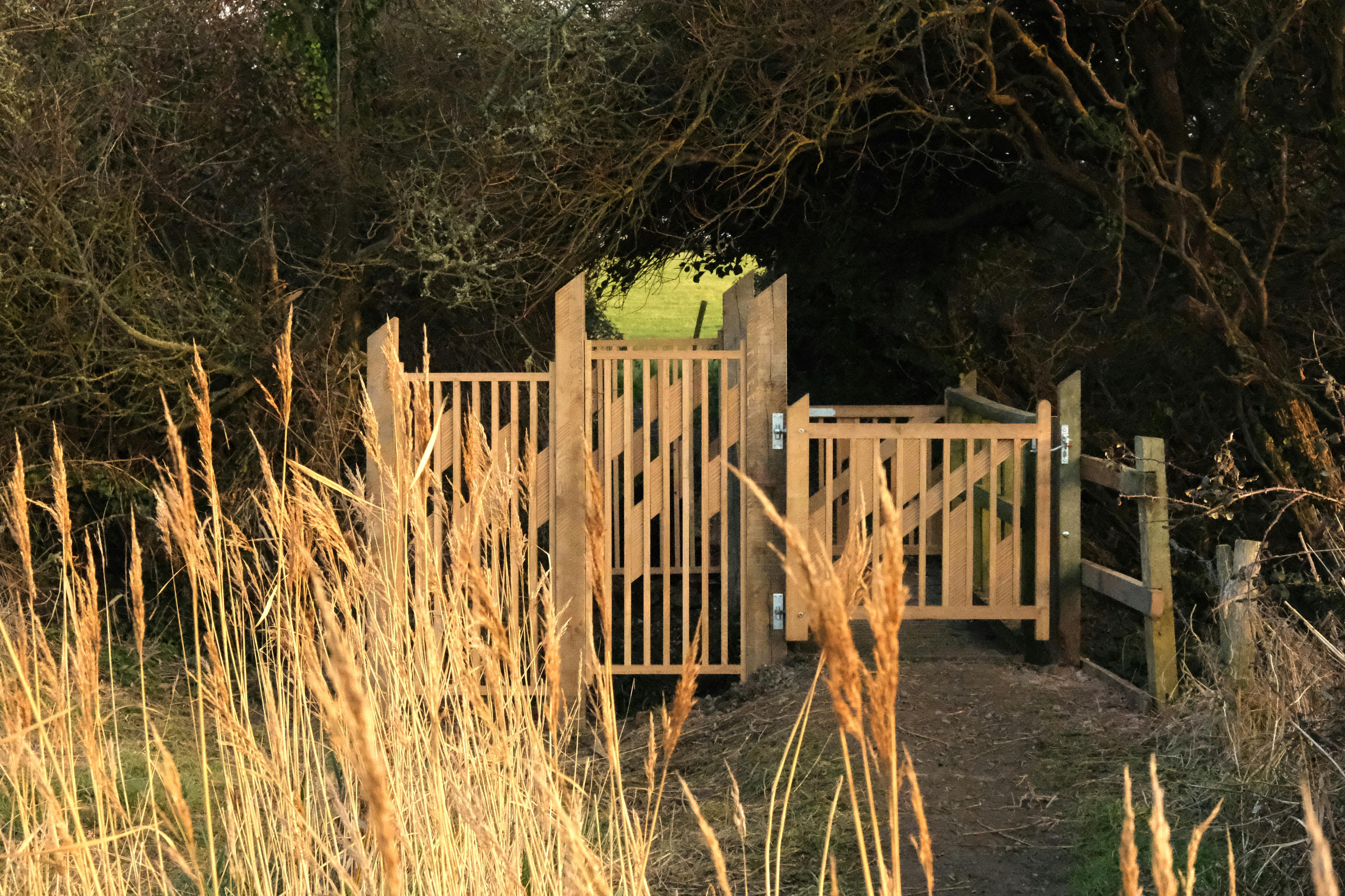
16. Chickerell to Fleet : Hand carved English oak gates with screens inspired by the unique landscape of the Fleet Lagoon and the reed beds at this location. Artists Eleanor Gould and Russell Denham. Grid Reference SY 64137 79220.
This project was led by Dorset Council and coordinated by Dorset Coast Forum as part of the Dorset Coastal Connections portfolio. Funding was from the Coastal Communities Fund, managed by the Ministry of Housing, Communities and Local Government (MHCLG).
For further information about this project please contact Dorset Coast Forum at dorset.coast@dorsetcouncil.gov.uk or Tel. 01305 224833.


Images of Parish Boundary marker artwork pieces during different design and productions stages (credit: Tara Hansford, Countryside Project Development Officer, Dorset Council)
Main image at top of page: Pete Millson