Project Overview
- Swanage Green Seafront Stabilisation - Swanage Town Council
- Shore Road Enhancements - Dorset Council
Project Overview
Welcome to the webpage for the The Swanage Green Seafront Stabilisation and Shore Road Enhancement Projects. Here you can find all information relating the projects as they progressed from 2023 until now.
Initially this webpage was for only the Green Seafront Stabilisation project but since 2025 there are two projects currently running in tandem:
Why are these projects needed?
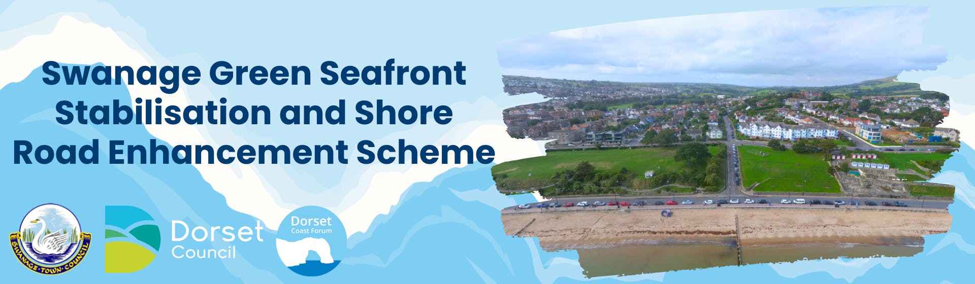
The objective is to stabilise and enhance these important green seafront areas for the benefit of both the Swanage community and its visitors. The Green Seafront is continuing to move, and works are essential to stabilise the land. Monitoring is ongoing and areas are being restricted to the public for safety reasons. For more information follow >> Why are these works required?
Whilst engaging on the first two options for Swanage Green Seafront in 2023 and the Swanage Masterplan, we found there were high levels of concern for the safety of people using the Northern Section of Shore Road. Therefore Swanage Town Council asked Dorset Council to consider alterations and enhancements.
In the first round of The Green Seafront Engagement in 2023 two options were presented to the community, the essential options and the enhanced option. Following the first round of engagement, proposals to improve pedestrian safety and accessibility on Shore Road are also being presented. You'll find information on both projects below.
What was new for the Round 2 Engagement for the Green Seafront?
In the second round (2025) we asked for views on a new option and the essential option that was presented previously. The enhanced option from round one was considered too expensive and so not taken forward. In addition, following your feedback setting out concerns regarding pedestrian safety on the northern section of Shore Road (the section open to vehicular traffic), the Town Council has been working in partnership with Dorset Council Highways Team and are presenting four options for this section of Shore Road that we would like your opinion on.
Here is an update from Tina Foster about the second round of engagement for the Swanage Green Seafront Stabilisation and Enhancement project!